An unofficial website featuring the West Somerset Railway
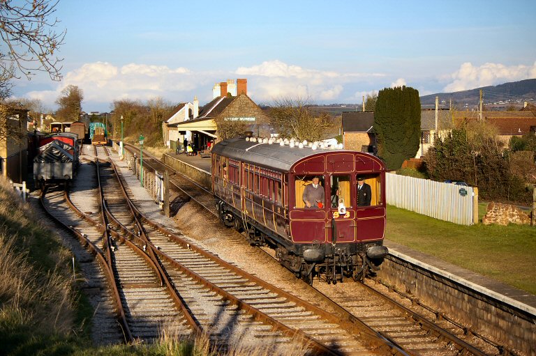
Washford Station
It's all downhill from here...
The following is from the official WSR webpage:
Washford is well-placed in the village it serves. It is beside the main A39 road between Williton and Minehead, but there is no car park and limited nearby street parking, and its single platform is accessed by steps from below.
The station was for many years occupied by the Somerset & Dorset Railway Trust, who used the main building to house a museum and the yard to store rolling stock. The station has been closed while the [Somerset & Dorset Railway] Trust vacated the site but reopened after some refurbishment.
There is a booking office, but facilities are limited, and further improvements are planned. The platform has an extensive grassy area, which is a pleasant place to watch and listen to the trains as they approach the station up steep gradients from both the Minehead and Bishops Lydeard directions.
In 2024, the yard was taken over by the West Somerset Railway Heritage Trust who have moved some of the Heritage Carriage Project vehicles to the site for eventual restoration.
More information...
Location...
- Postcode: TA23 0PP
- OS Grid Reference: ST044411
- Geographic Coords: 51.1614, -3.3676
- what3words: ///consoled.beast.depend
The Stations...